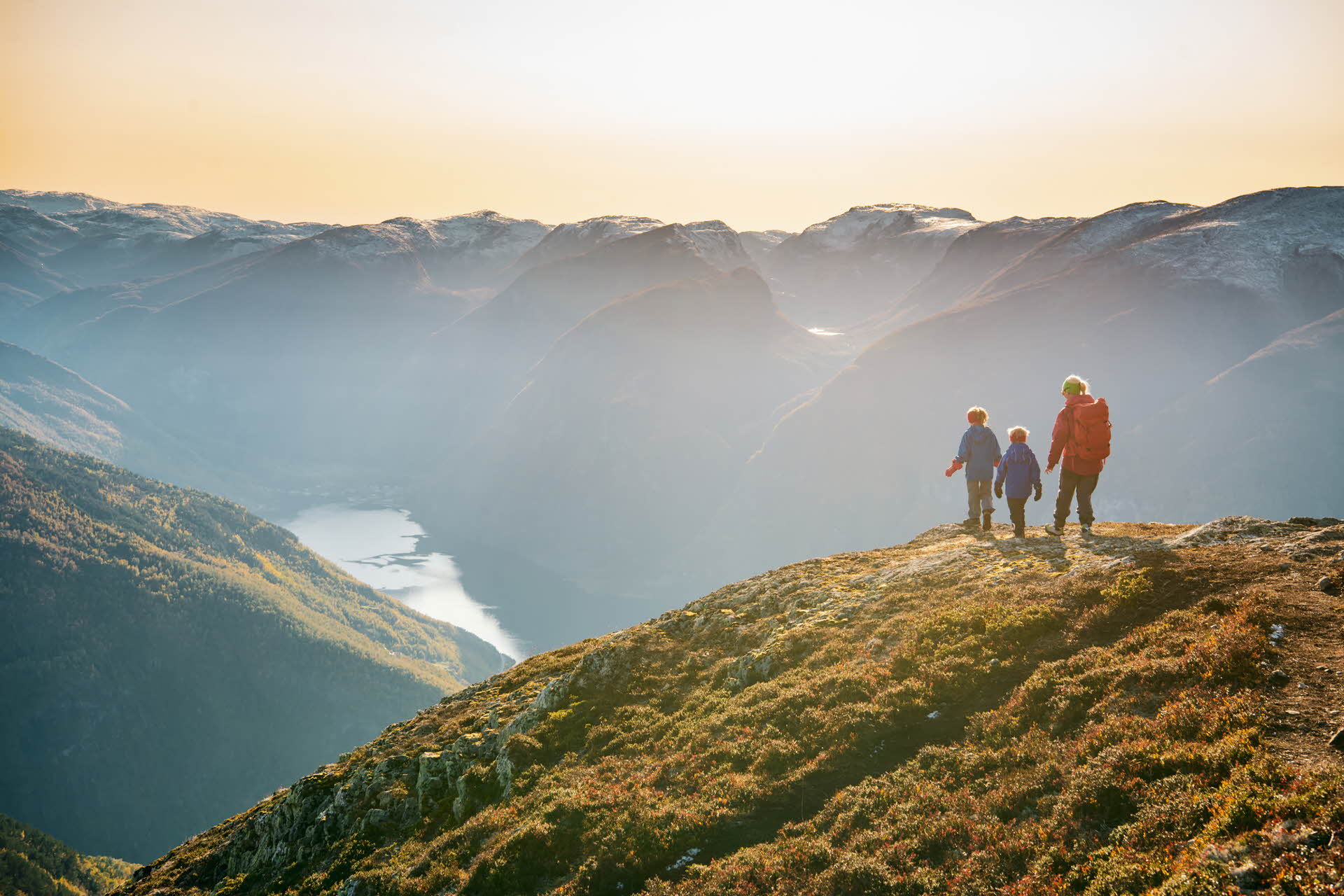
1. Prest
Prest at 1,478 metres above sea level offers panoramic views across the Aurlandsfjord. This is a brilliant hike for all the family. It’s not a very long hike, but parts of the path are steep and there are sheer drops off the sides at times. To get to the starting point, you drive past the Stegastein viewing platform above Aurland. There’s a car park just after the Bjørgo farm. There’s a good, marked path all the way. The first part, towards Hovden, is gentle but gets steeper further up. There’s a sheer drop at Røyrgrindgjelet, where the path runs steeply down towards the farms below Prest.
The best views across the fjord landscape, Aurland and Flåm are from the beacon at 1,363 metres above sea level. The actual peak itself is just over 100 metres further up – in altitude, that is. If a longer trip is more your thing, you can carry on to Blåskavlen (1,809 metres above sea level), which is the highest peak in the municipality of Aurland. The trip to Prest is around 2.5 kilometres long and you should expect to spend just over 3 hours getting there and back.
Tip: Buy a tasty packed lunch from Flåm Bakeri to enjoy as you take in the view from the peak!
2. Day trip cabin in Aurland
All municipalities in the former Sogn og Fjordane have their own day trip cabins, built as low-level offerings for hikers. These cabins are around 15 sq m in area and provide most places where you can eat your packed lunch and flip through books from the collection available.
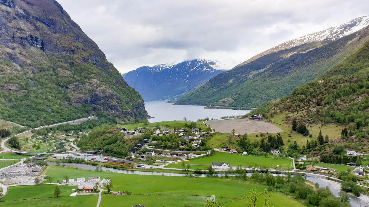
In the municipality of Aurland, the Vinjaåsenhytta daytrip cabin is located on the path between Aurlandsvangen and the Stegastein viewing platform. If you’re staying at the Hotel Aurlandsfjord, you just have to go out of the door and look up. The cabin is around 300 metres above the fjord, and it’ll take you about 1.5 hours to get there at a moderate pace. Even though parts of the path may be slippery when it’s been raining a lot, and one section through a rough patch can be a little bit challenging, this is a great trip for all the family. That sense of overcoming something will come when you see the view from the cabin.
If you want to carry on walking, you can carry on up to the Stegastein viewing platform at 650 metres above sea level.
3. Hovdungo from Vikesland
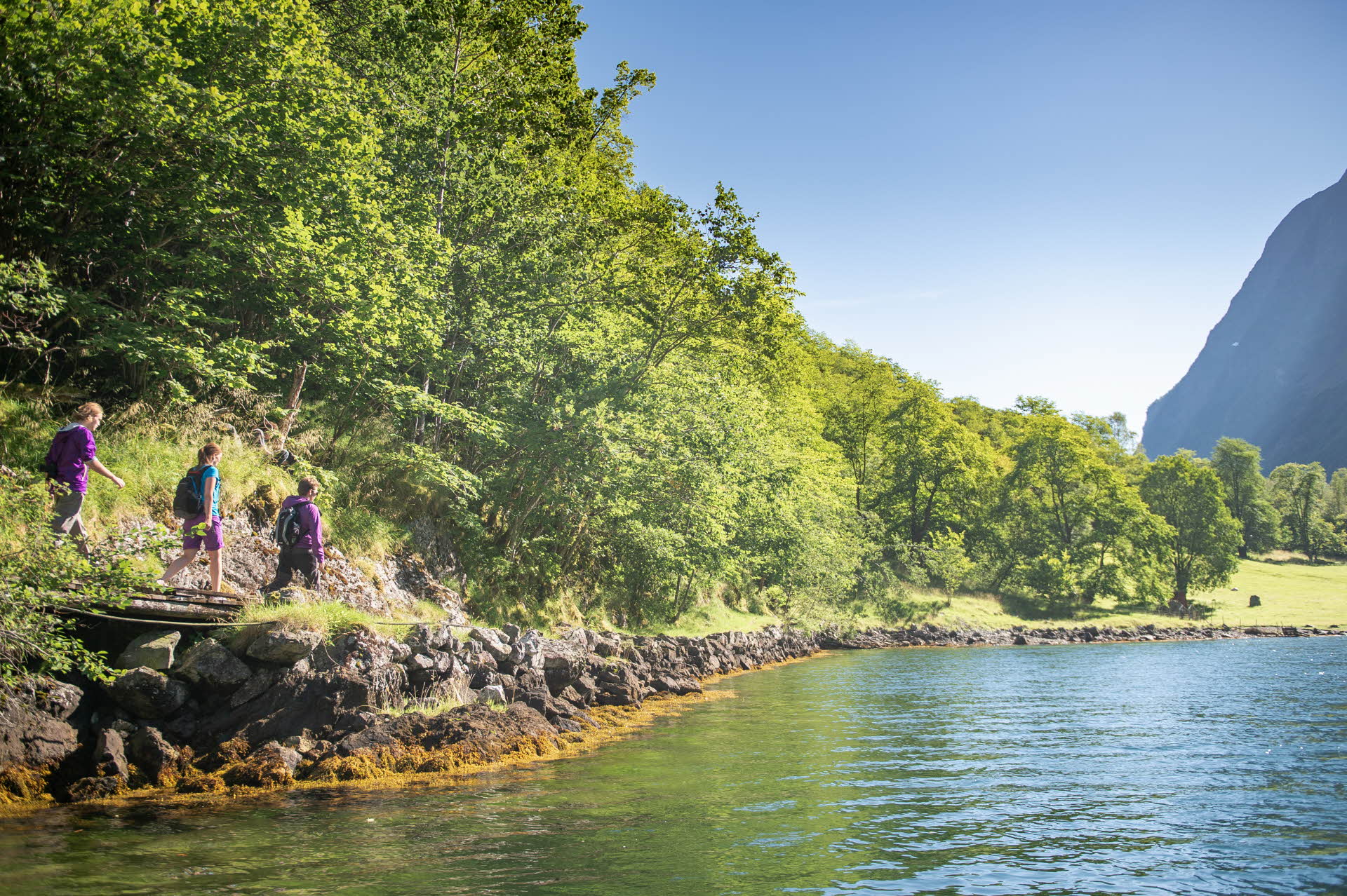
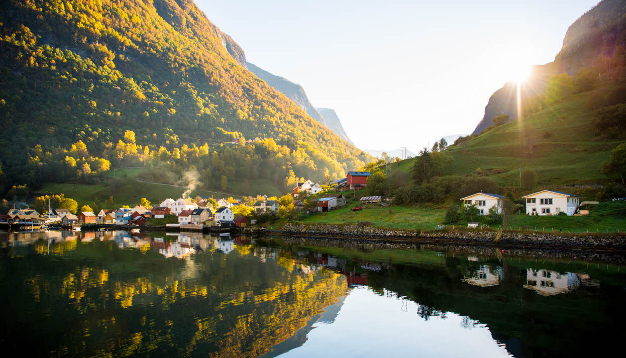
The trip to Hovdungo is an Aurland classic. Not many farms are in a more beautiful location than Hovdungo at 780 metres above sea level, with its fantastic view down to Aurlandsvangen and across the Aurlandsfjord. The path up to there is signposted and starts at Vikesland, 460 metres above sea level, where there’s space to park along the gravel track or on the bend below the last farm. You can enjoy impressive views into the fjord and Flåm from here.
The trip begins on a relatively gentle gravel track but soon turns quite steep. The last part is gentle again, so you have the chance to get your breath back before the view takes your breath away again. From here, you can walk another 500 metres to the Berget viewing platform, 808 metres above sea level, where you can look in towards Vassbygdi towards the Aurlandsdalen Valley and enjoy excellent views over the region around Prest, Stegastein and Turlifossen. If you want to go a bit further, you can carry on to Liahovden (1,444 metres above sea level) or Blåskavlvarden (1,442 metres above sea level).
When you’re on your way back down, you can take a detour to the old Trolladokki ski jump, which was built in the 1930s. The 52-metre record for a jump from there was set in 1935. You can still see the beautifully finished overrun and the log cabin that was used as a clubhouse.
4. Ørnareiret above Undredal
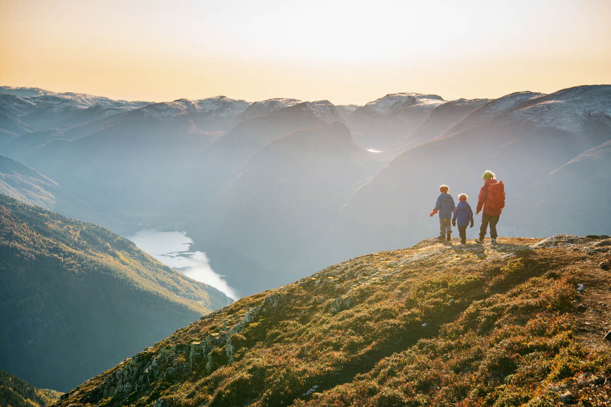
Ørnareiret, a shelter sleeping 6, can be found a thousand metres directly above Undredal and the Aurlandsfjord. This really does give you a bird’s eye view of the fjord landscape!
Your trip starts in central Undredal and continues up the steep mountainside. At the second farm, Hovdungo in the municipality of Aurland, you can take a quick breather on the hill. There are beautiful views across the Aurlandsfjord here, so there’s no need to carry on if you don’t feel like it.
But you can carry on over the mountain and get down to Stigen gård further out in the Aurlandsfjord. Remember, you have to sort out transport by boat if you won’t be going back the same way.

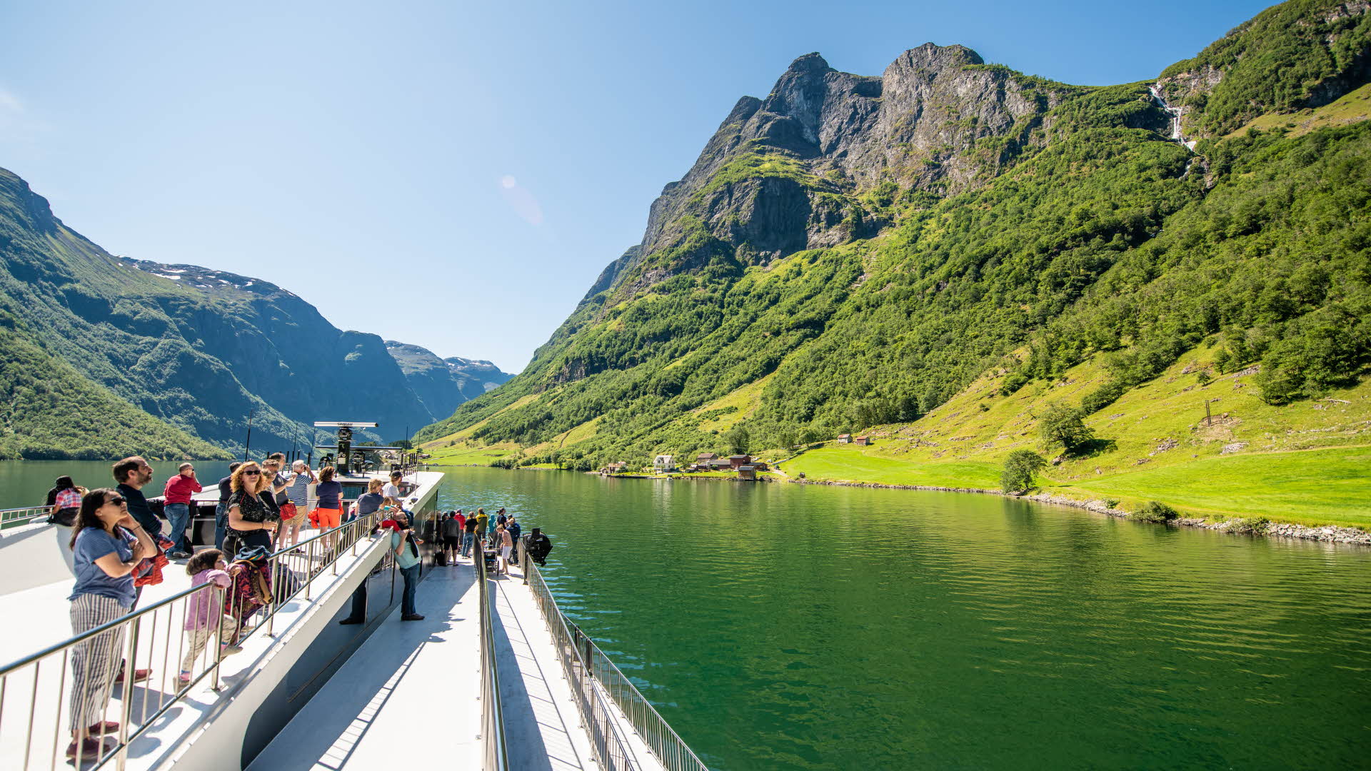
5. The Royal Postal road
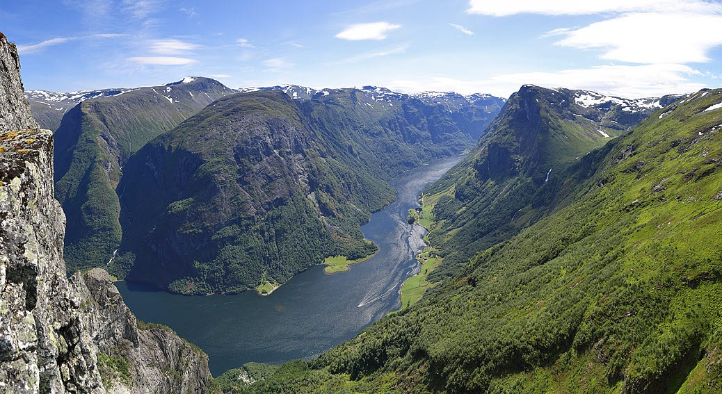
This may not be a mountain trip, but when it comes to fjord views there’s nothing to choose between Styvi and Bleiklindi along the Nærøyfjord. This 5.5 km-long path was built in the mid-17th century and was part of the Norwegian Postal route until steamboats took over in 1858. This path was used when the fjord was frozen in winter. The post came from Bergen via Voss and Stalheim to Bakka, where it was transported across the fjord to Bleiklindi and on via the mailroad to Styvi farm. The farmers at Styvi were mail farmers and took the mail to and from Lærdalsøyri by rowing boat.
Nowadays, you can get to Styvi aboard a fjord cruise from Flåm or Gudvangen. The old postal farm is no longer operational, but it’s kept in good condition. From here, you follow the path – it alternates between going all the way by the edge of the fjord and becoming more of an integral part of the terrain above. You’ll pass waterfalls and streams, walk on old walls and enjoy amazing views across to the Nærøyfjord all the way. At Bleiklindi, why not enjoy your packed lunch and maybe a swim? The name “Bleiklindi” – pale linden – came about because of the big, old linden tree, which has particularly pale leaves. You can go back the same way and take the boat back to either Gudvangen or Flåm.
6. Dyrdal to Hjølmo
This route perhaps has the least spectacular fjord views, but it provides a good insight into life next to the fjord as it used to be. Dyrdal is an idyllic little fjord village, with no road connection, along the Nærøyfjord. Farming has taken place here for centuries, and at its peak more than 100 people lived here and had their own school and infirmary. The last farmer gave up farming in the 1970s, and now only one man still lives in Dyrdal. As this region is part of the West Norwegian Fjords on UNESCO’s World Heritage List, both the buildings and the cultural landscape are kept in good condition and animals are sent here by boat from other places along the Sognefjord in order to graze in summer.
From the quay at the fjord, there’s a gravel track 5 kilometres up the valley to Hjølmo farm. On your way there, you’ll pass the grand farm of Drægo, which has probably been operational since before Dyrdal farm itself. From Hjølmo, you can continue up into the mountain, to the Vassete summer farm or all the way to Breiskrednosi.

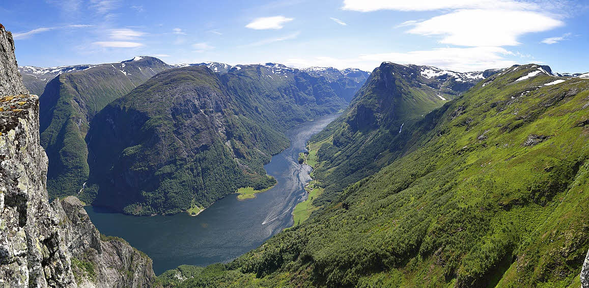
7. Rimstigen
Rimstigen Opp is a famous 2.7-kilometre mountain race that ascends 725 metres. If you take the time to stop and enjoy the view towards the Nærøyfjord and Tuftefossen, this is still a walk most people could do.
This path starts between Bakka and Tufto at the Nærøyfjord, and you get here by car from Gudvangen. The path takes a steep turn up the mountainside under Bakkanosi and Rimstigfjellet. Great views over the fjord are available pretty much instantly on your way up. From the path, you can take a detour and get all the way down to the beautiful Tuftefossen. This area is very susceptible to avalanches in winter, and you’re sure to see the remnants of old avalanches.
When you get to the top, you’ll be ready for a nice rest as you enjoy the fantastic view across the fjord. After that, a number of choices are open to you. You can turn round and head back down the same route straight away, or you can take the gently sloping path inwards to Rimbotn. There’s a small body of water here – maybe you could be tempted to enjoy a swim here? Or if you fancy even more spectacular views, carry on up the old transport route between Dyrdal, Jordalen and Bakka and on to either Breiskrednosi or Bakkanosi. You can find out more about these peaks below.
8. Breiskrednosi
Breidskrednosi is truly a hidden gem. From the top, there is nothing less than an amazing view of the Nærøyfjord towards Bakkanosi and Gudvangen.
We recommend to follow the trail up Rimstigen to Skarsvotni lake and then follow the old transport route to Dyrdal with a small detour out on Breiskrednosi summit. The last 5 kilometres from Hjølmo is gravel road. When you reach Dyrdal, we suggest you take a refreshing swim in the fjord while waiting for Fjord Cruise Nærøyfjord to take you back to Aurland or Flåm. Just remember to check the cruise's timetable before setting out.
Alternatively, you can walk return trip from Bakka or you can start at Dyrdal.
Get to Bakka by bus from Aurland and Flåm.

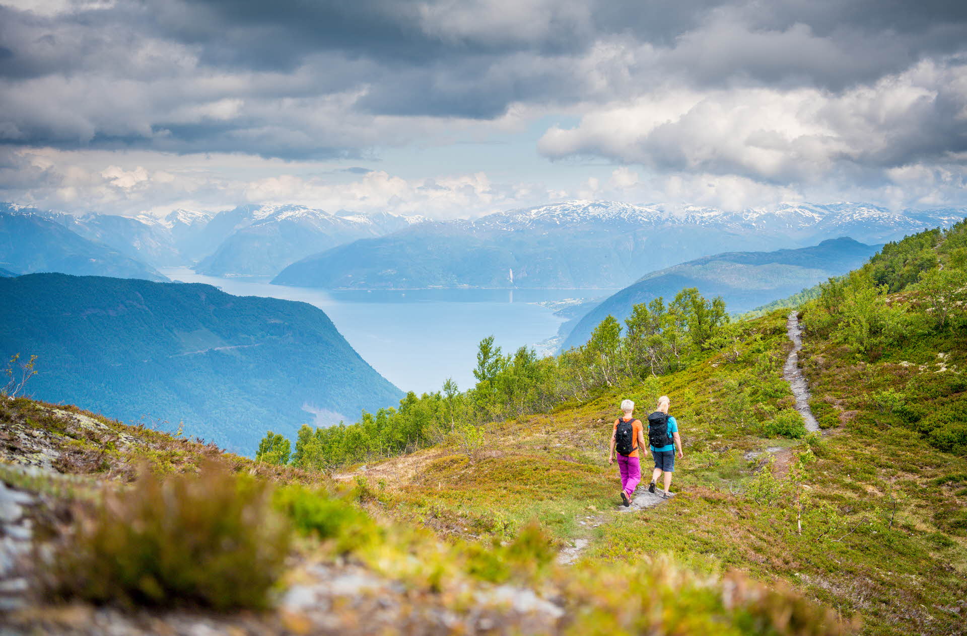
9. Ovriseggi on Vikafjell
Walking options with fjord views aren’t just available in Flåm and Aurland. Myrkdalen Mountain Resort is situated just 45 minutes’ drive from Vik by the Sognefjord, and the Vikafjell mountain plateau between has a range of trails of varying difficulty and length to offer. Ovriseggi is a family-friendly walk, with fantastic views over Vikøyri and the Sognefjord and across towards Vangsnes, Hella, Balestrand and the beautiful Kvinnafossen waterfall on the other side of the fjord.
From Myrkdalen, you drive towards Vik and there’s a little gravel track up on the right just after the tunnel – park here. The path along the edge is signposted and easy to find. This is a gently undulating walk and probably the least steep of the walks on this list, with the exception of the mailroad along the Nærøyfjord, since you’ve already driven up onto the plateau. Set aside a total of 2-3 hours to get to and from Daurmålshaugen. If you want to go a bit further, you can carry on to Store Svingen above Vik, or all the way down to Vikøyri.
10. Brekkefossen waterfall
The Raokjen viewing platform at Brekkefossen is a nice little walk from the Fretheim Hotel, and is ideal as an evening walk from the Fretheim Hotel, for example. The first part of the walk goes 1.5 kilometres along a surfaced road, along the lovely farms by the Flåmselv river towards Haugen Gard. Just before Haugen, you’ll see a signpost for Brekkefossen. From there, you follow a gravel track for a short way before you come to the beautiful stone steps that were built by Sherpas.
You head up these steps for 500 metres, and then the view opens up in front of you. Not only are you directly next to the huge waterfall, you also have panoramic views across Flåm and the innermost part of the Aurlandsfjord. Sit down and enjoy the view before going back the same way.
If you feel like a longer walk, you can either carry on up the path in the mountain towards Grindaflethytta and Stalheim or walk across Fretheimshaugane back to the fjord.